Places: Low


Widget not in any sidebars

Place Type

Chapelry

County

Lancashire

Parish

Blackburn

Deanery

Blackburn

Causes

EDC 5/11/1 – Sir Thomas Langton, farmer of the tithes of the chapelry of Low, contra Lawrence Banastre

LOW (or WALTON-LE-DALE)

Walton-le-Dale was a township and chapelry in the parish of Blackburn. The chapel, dedicated to St Leonard, was also known as Low Chapel and it seems that the chapelry was known both as Low and Walton-le-Dale. It is situated on the south bank of the River Ribble at the confluence of the River Darwen, almost opposite to the town of Preston. The banks of both rivers rise steeply, and the chapel is situated of high ground overlooking the rivers. Farming in the parish was largely pastoral with some arable and woodland and there was market gardening on the lower ground. By the mid-nineteenth century the cotton industry had developed and there was an iron foundry.

The manor of Walton was owned by the Banastre family and passed by marriage to the Langtons in the fourteenth century and then to the Hoghton family in the reign of Elizabeth. In a tithe cause brought by Thomas Langton against Laurence Banastre, Langton is described as ‘baron of Walton’.

The chapelry belonged to the monastery of Whalley. However, it seems that local residents resented the influence of the monastery. In 1525 Thomas Langton refused to allow any priest appointed by the abbot of Whalley to serve the chapelry and in 1526 some residents refused to pay mortuaries to Whalley. They were summoned to appear before the consistory court at Lichfield, but the case was eventually dismissed. Following the suppression of Whalley in 1537 the chapel with its tithes was valued at £27 11s 2d and  passed under lease to Richard Breame and then, in 1547, to Archbishop Thomas Cranmer together with the rectory of Blackburn (A History of the County of Lancaster: Volume 6). It became a perpetual curacy.

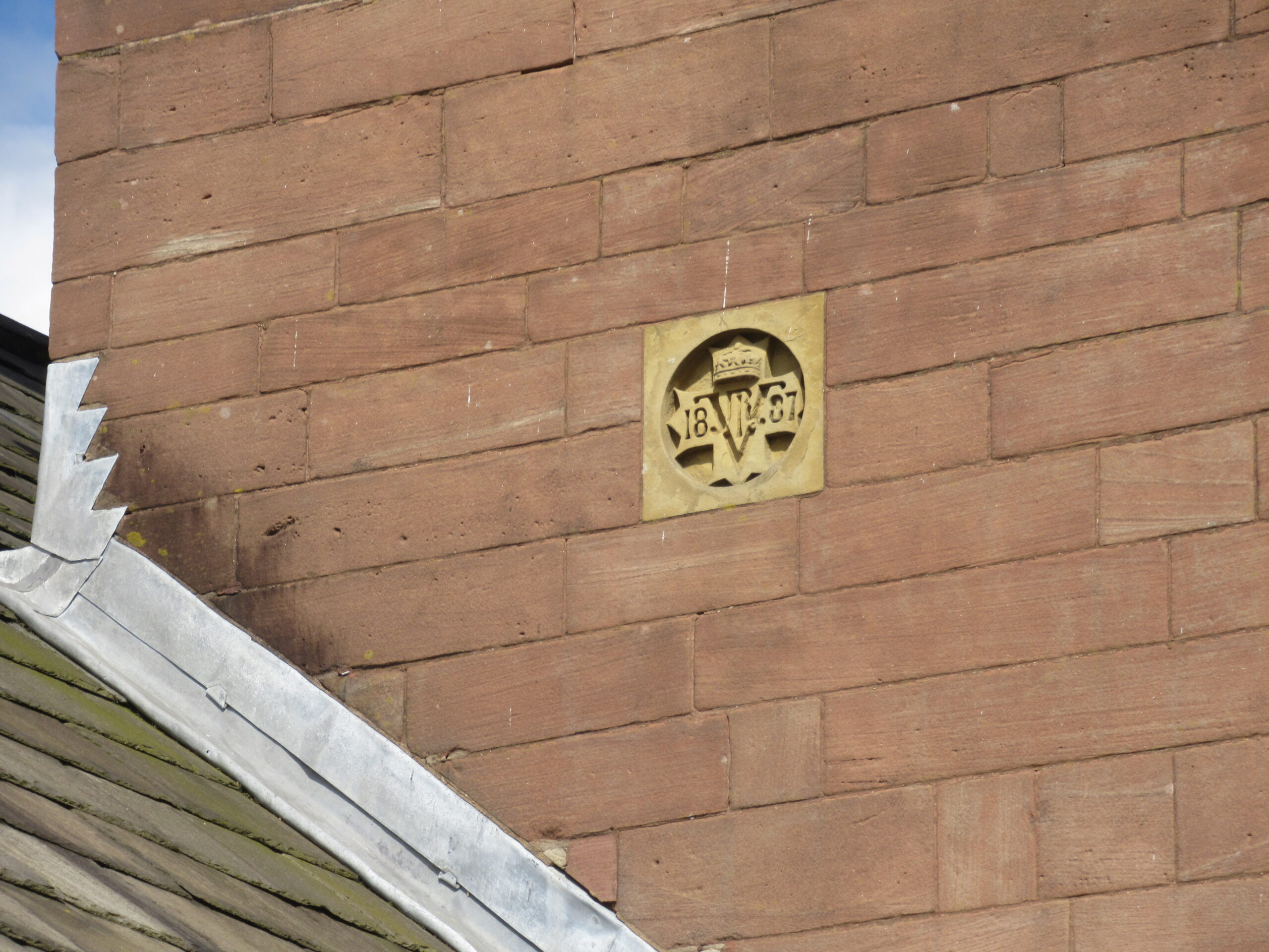
The tower of the parish church building is late medieval, as is the chancel, but most of the rest of the building dates from the beginning of the twentieth century.

Sources:

Christopher Haigh, Reformation and Resistance in Tudor Lancashire (Cambridge, 1975), pp. 32, 57 (Haigh refers to this chapelry as ‘Lawe’)

‘Walton – Walton, Wood’, in A Topographical Dictionary of England, ed. Samuel Lewis( London, 1848), British History Online https://www.british-history.ac.uk/topographical-dict/england/pp453-457 [accessed 5 January 2025]

‘Townships: Walton-le-Dale’, in A History of the County of Lancaster: Volume 6, ed. William Farrer, J Brownbill( London, 1911), British History Online https://www.british-history.ac.uk/vch/lancs/vol6/pp289-300 [accessed 5 January 2025]

Historic England:
Church of St Leonard, Church Brow (1074102)
https://historicengland.org.uk/listing/the-list/list-entry/1074102 National Heritage List for England

Places: Ashton upon Mersey


Widget not in any sidebars

Place Type

Parish

County

Cheshire

Parish

Ashton upon Mersey

Deanery

Frodsham

Causes

EDC 5/9/3 – William Renshaye contra Clement Bent alias Renshaye

ASHTON UPON MERSEY

Ashton upon Mersey is situated on the south bank of the River Mersey. It was formerly in Cheshire but is now part of Trafford district of Greater Manchester. The parish comprised the township of Sale and half of Ashton and was a rectory of which the advowson was owned by the Ashton family who held a portion of the manor of Ashton. During the seventeenth century, however, it passed from the Ashtons to a succession of other families.

An early church building, dating from 1304, was destroyed by a storm in 1704. Money was needed for the construction of a new church, and church briefs were collected to help out. It presumably took some time to raise the necessary funds. In 1710, for example, the amount of 12s was raised in Reading and 2s 9½p came from a Sussex parish in 1711.

Eventually the new church was built and finished, probably in 1714 in accordance with the date over the north porch. It was later extended during the nineteenth century. These extensions included the addition of a large, square brick tower, topped by a timber-framed belfry, built in 1887 to commemorate Queen Victoria’s Golden Jubilee.

In the nineteenth century some market gardening, notably the production of potatoes, was carried out in the area for the Manchester market. The area of the parish is now largely residential although an early nineteenth-century farmstead has been preserved in the conservation area around the church.

Sources:

George Ormerod, The History of the County Palatine and City of Chester (second edition, revised and enlarged by T. Helsby, London, 1882), vol. i, pp. 558-566 

Raymond Richards, Old Cheshire Churches (Revised and enlarged edition, Didsbury, 1973), pp. 22-24 

CCEd location ID: 4994

Cheshire Sheaf, 3rd Series, xvi, p. 2; 2nd Series, i, p. 88

‘Ashton – Ashton, West’, in A Topographical Dictionary of England, ed. Samuel Lewis( London, 1848), British History Online https://www.british-history.ac.uk/topographical-dict/england/pp90-96 [accessed 31 December 2024]

Historic England:
Church of St Martin, Church Lane (1067893)
https://historicengland.org.uk/listing/the-list/list-entry/1067893 National Heritage List for England


Click to view fullscreen

Places: Shocklach


Widget not in any sidebars

Place Type

Parish

County

Cheshire

Deanery

Malpas

Causes

EDC 5/3/2 – Sir Richard Brereton contra Thomas Valentine


SHOCKLACH

This small parish, on the border of Cheshire and Wales, comprised three townships: Church Shocklach, Shocklach Oviatt and Caldecott. There are the remains of two castles at Shocklach, included in one entry in the National Heritage List for England. The site to the east (pictured below) was a motte and bailey castle, originally constructed soon after the Norman Conquest, in part as an element in a defensive network along the River Dee to protect against Welsh incursion. The site to the west was a motte castle, understood to have been built later. This site is ‘the only example in Cheshire of paired mottes’. There was later a toll gate across the road separating the castles, giving them an added commercial function and making Shocklach ‘certainly a place of significance in medieval England.’ (Swallow, pp. 35-36).

The Brereton family of Malpas held much of the land in the parish. Members of this influential family held positions at the courts of Henry VII and Henry VIII and in 1572 they bought the manor of Shocklach.

The parish belonged to the college of St John in Chester until the dissolution of the college in 1547 or 1548 when it passed to the king and continued to be served by a stipendiary curate. The dean and chapter of the college had granted a lease of the parish to William Brereton from 1533 for 5 years, but he was executed for treason in 1536 and his personal property passed to the crown.

The small parish church, dedicated to the Ango-Saxon Saint Edith of Polesworth, is built in red sandstone with a slate roof and the earliest parts, including the south doorway, are thought to date from the mid-12th century. The font dates from the 15th century although the carving on the bowl has been restored. The pulpit is embellished with the date ‘1687’ set out in brass nails. The problems of travel in the area during the eighteenth century are evidenced by an inscription scratched into one of the windows of the chancel which states that three visitors in 1756 found the local roads so bad that they felt in danger of their lives.

In the north wall of the nave is a stone carving of a mounted person. Opinion is divided as to whether this is a 17th century knight or, as the horse appears to have more than 4 legs, it may be a Viking carving depicting Odin riding Sleipnir, his 8-legged mount.

In the churchyard is part of a medieval cross which may have been used as a plague stone where food and water were left for victims.

The area of the parish remains largely agricultural, and parts of a medieval field system and the earthwork remains of the related settlement have survived.

Sources:

J S Barrow, J D Herson, A H Lawes, P J Riden, M V J Seaborne, ‘Churches and religious bodies: The collegiate church of St John’, in A History of the County of Chester: Volume 5 Part 2, the City of Chester: Culture, Buildings, Institutions, ed. A T Thacker, C P Lewis( London, 2005), British History Online https://www.british-history.ac.uk/vch/ches/vol5/pt2/pp125-133 [accessed 29 December 2024]

E. W. Ives (ed.), Letters and accounts of William Brereton of Malpas (The Record Society of Lancashire and Cheshire, 116, 1976), pp. 1, 108

George Ormerod, The History of the County Palatine and City of Chester (second edition, revised and enlarged by T. Helsby, London, 1882), vol. ii, pp. 684-693

Rachel Swallow, ‘Two for One:  the Archaeological Survey of Shocklach, Castle, Cheshire’, Cheshire History, (53), (2013-2014), pp. 18-44

Cheshire Sheaf, 3rd Series, xvi, pp. 48-49

Historic England

Church of St Edith, Worthenbury Road (1228322)
https://historicengland.org.uk/listing/the-list/list-entry/1228322 National Heritage List for England
Medieval Cross in St Edith’s Churchyard, South of Church (1228350)
https://historicengland.org.uk/listing/the-list/list-entry/1228350 National Heritage List for England
Medieval settlement and part of field system at Castletown Farm (1016588)
https://historicengland.org.uk/listing/the-list/list-entry/1016588 National Heritage List for England
Shocklach Castle Motte and moated enclosure (1012620)
https://historicengland.org.uk/listing/the-list/list-entry/1012620  National Heritage List for England


Click to view fullscreen

Places: Irton


Widget not in any sidebars

Place Type

Parish

County

Cumberland

Deanery

Copeland

Causes

EDC 5/10/2 – Roger and Ellen Fulbeke and Nicholas Jacson, farmers of the tithes of Irton, contra John and Nicholas Sherween and Roland Hartley.

IRTON

The parish of Irton, standing on the River Irt and lying in the south west of the county of Cumberland, included the townships of Irton, Melthwaite and Santon. By the early twentieth century the parish ‘consisted almost entirely of scattered farms, and lying neither upon the sea coast nor among the mountains, though very near to both.’ (Moor, p. 148) However, there was a granite quarry near Irton Hall, where the Irton family lived for centuries.

Christopher Jackson of London claimed in about 1508 that 10 acres of land in Irton, previously owned by Calder Abbey, had been sold to his father by his uncle, who had been abbot of Calder. By the time that the Valor Ecclesiasticus was drawn up in 1535 Calder Abbey is not recorded as owning any land in Irton (Thorley, p. 158). It is possible that Nicholas Jackson, one of the plaintiffs in a Chester tithes cause (EDC 5/10/2), was related to Christopher Jackson.

The rectory was appropriated to the nunnery of Lekeley (also called Seton) in the thirteenth century. Following the dissolution of the convent in 1536 Sir Hugh Askew of the king’s household acquired the lease of the rectory and was granted a further lease for 21 years in 1543.

The parish church building dates from the mid-nineteenth century, having been rebuilt on the site of a medieval building.

Sources:

John Thorley, ‘The Estates of Calder Abbey’, Transactions of the Cumberland and Westmorland Antiquarian & Archaeological Society, series 3, vol. 4 (2004), pp. 133-162

Rev. C. Moor, ‘The Old Statesman Families of Irton, Cumberland’. Transactions of the Cumberland and Westmorland Antiquarian & Archaeological Society, series 2, vol. 10 (1910), pp. 148-200

‘Irby – Isfield’, in A Topographical Dictionary of England, ed. Samuel Lewis( London, 1848), British History Online https://www.british-history.ac.uk/topographical-dict/england/pp620-623a

‘Houses of Benedictine nuns: The nunnery of Seton or Lekeley’, in A History of the County of Cumberland: Volume 2, ed. J Wilson( London, 1905), British History Online https://www.british-history.ac.uk/vch/cumb/vol2/pp192-194 [accessed 2 January 2025]

Historic England:
Church of St Paul (1086671)
https://historicengland.org.uk/listing/the-list/list-entry/1086671 National Heritage List for England


Places: Saighton


Widget not in any sidebars

Place Type

Township

County

Cheshire

Parish

St Oswald, Chester

Deanery

Chester

Causes

EDC 5/10/1 – William Aldersey contra Thomas Wright and Richard Broster


SAIGHTON (SALGHTON/SAUGHTON)

The manor of Saighton was held by the canons of Saint Werburgh’s before the Norman Conquest and confirmed to the Benedictine monks in 1093 following the establishment of the abbey. A manor house was built at Saighton in the late fifteenth century for Abbott Simon Ripley.

After the dissolution of the abbey, Saighton Manor, with other lands, passed to the dean and chapter of the new cathedral. However, during the reign of Edward VI Sir Richard Cotton, comptroller of the royal household, procured the arrest and imprisonment of the dean and two of the prebendaries who were intimidated into granting him a lease of most of the cathedral lands at a reduced rent. Despite attempts by later deans to overturn this unfavourable lease it was confirmed by Queen Elizabeth, although at a higher rent.

The gatehouse of Simon Ripley’s manor house, dating from 1490, survives and is now part of a private school attached to the Victorian manor house which replaced the previous medieval buildings following purchase of the property by the Grosvenor family.

Part of the boundary wall to the north and west of old gatehouse is on the National Heritage List for England and is understood to be medieval.

A large army training camp was built in Saighton during the Second World War. It was closed in about 1999 and the land has since been redeveloped for residential housing.

The village remains a largely agricultural area.

Field names 

named in EDC 5/10/1 :
beggarsborough
The tithe map for Saighton, drawn up in 1840, records six plots in the township with name variations of ‘Beggars Brook’ https://maps.cheshireeast.gov.uk/tithemaps/


Sources:

R. V. H. Burne, Chester Cathedral From its Founding by Henry VIII to the Accession of Queen Victoria (London, 1958), pp. 24-26, pp. 72-82

George Ormerod, The History of the County Palatine and City of Chester, (second edition, revised and enlarged by T. Helsby, London, 1882) vol. i, pp. 253-255; vol. ii, pp.769-770 (black and white image from this volume courtesy of HathiTrust)

Historic England:
Boundary Wall North and West of Abbey Gate College (1330250)
https://historicengland.org.uk/listing/the-list/list-entry/1330250 National Heritage List for England
Abbey Gate College Gatehouse Gateway (1138394)
https://historicengland.org.uk/listing/the-list/list-entry/1138394 National Heritage List for England
Abbey Gate College, the Main Block except the Gatehouse (1136660)
https://historicengland.org.uk/listing/the-list/list-entry/1136660 National Heritage List for England

Click to view fullscreen

Places: Eccleston, Cheshire


Widget not in any sidebars

Place Type

Parish

County

Cheshire

Parish

Eccleston

Deanery

Chester

Causes

EDC 5/10/1 – William Aldersey contra Thomas Wright and Richard Broster


ECCLESTON

The parish is about three miles from Chester and comprised two townships, Eccleston and Eaton, with the hamlet of Belgrave. The village of Eccleston is situated on the River Dee. A surviving motte and associated earthworks overlooking the River Dee were constructed just after the Norman Conquest on a Roman road which crossed the Dee by a ford at Eccleston.

The advowson of the rectory was owned by the lords of the manor who were the Venables family, barons of Kinderton, for much of the sixteenth century. The manor was sold in the eighteenth century to the Grosvenors of Eaton.

The church was rebuilt in the early nineteenth century in sandstone under the direction of the Grosvenor family and underwent further reconstruction later in the century. The beautiful churchyard overlooking the river became so popular as a burial place for the people of the nearby city of Chester that in an effort to restrict burials of outsiders non-parishioners were heavily charged for the privilege of interment there. A new parish church was constructed in 1899, again at the expense of the Grosvenor family in the person of the 1st Duke of Westminster, and the family also had a private chapel on their estate.

The parish remains largely agricultural, being arable and pasture, although there was a quarry for sandstone used for building. There were also salmon fisheries on the River Dee and a ferry across the river. Eaton Hall, seat of the Grosvenor family, is situated in the parish.

The area of London developed by Richard Grosvenor from 1826 was nicknamed ‘Belgravia’, the name taken from the title of Viscount Belgrave bestowed upon the family in 1784. This residential development included fashionable Belgrave Square, Eaton Square and Chester Square. The title of Duke of Westminster was created for Hugh Grosvenor of Eaton in 1874.

Sources:

Debrett’s Peerage, Baronetage, Knightage and Companionage (London, 1889), pp. 733-734

George Ormerod, The History of the County Palatine and City of Chester (second edition, revised and enlarged by T. Helsby, London, 1882), vol. ii, pp. 824-844

Edward Walford, ‘The western suburbs: Belgravia’, in Old and New London: Volume 5( London, 1878), British History Online https://www.british-history.ac.uk/old-new-london/vol5/pp1-14

‘Eccleston – Edgbaston’, in A Topographical Dictionary of England, ed. Samuel Lewis( London, 1848), British History Online https://www.british-history.ac.uk/topographical-dict/england/pp139-144

Historic England
Motte and associated earthworks east of Old Rectory (1011118)
https://historicengland.org.uk/listing/the-list/list-entry/1011118  National Heritage List for England
Remains of Former Church of St Mary, Old Churchyard (1138376)
https://historicengland.org.uk/listing/the-list/list-entry/1138376 National Heritage List for England
Church of St Mary (1138410)
https://historicengland.org.uk/listing/the-list/list-entry/1138410 National Heritage List for England
Eaton Chapel North of Eaton Hall (1330615)
https://historicengland.org.uk/listing/the-list/list-entry/1330615 National Heritage List for England


Click to view fullscreen

Places: Dwellings (Lancashire)


Widget not in any sidebars

Place Type

Dwelling

County

Lancashire

LANCASHIRE DWELLINGS BY PARISH

PARISH OF BURY

EDC 5/8/1 – Richard Smyth, rector of Bury, contra Arthur Cay

Cobholes

Places: Bury


Widget not in any sidebars

Place Type

Parish

County

Lancashire

Parish

Bury

Deanery

Manchester

Causes

EDC 5/8/1 – Richard Smyth, rector of Bury, contra Arthur Cay


BURY

The parish of Bury comprised the townships of Bury, Elton, Heap, Walmersley with Shuttleworth, Tottington (Higher End and Lower End), Musbury, Cowpe, Lench, Newhall Hey and Hall Carr and the hamlet of Ramsbottom together with the chapelries of Edenfield, Heywood and Holcombe, each of which usually had a curate. Although all were included in the county of Lancashire, parts of the parish are now included in Greater Manchester.

The parish was a rectory in the gift of the lord of the manor, which had passed to the Pilkington family by the fifteenth century. The manor was acquired by the Stanley family on the accession of Henry VII in 1485 having been confiscated because of the Pilkingtons support for Richard III. The Stanleys also acquired and retained the advowson.

In 1523 or 1524 there was a short-lived attempt to establish at Bury a second Consistory Court for the archdeaconry of Chester serving the northern area. Richard Smyth, the rector of Bury, was the commissary in charge there until it was abandoned within ten years.

The church building is situated at the highest point in the town of Bury near to the remains of the castle which was in ruins by the early sixteenth century and demolished about 1644 during the parliamentary siege of the town.

There is understood to have been a church in Bury at the time of the Norman conquest. This was restored or rebuilt in about 1535, but by the middle of the eighteenth century this building had become so dilapidated that it was demolished and rebuilt between 1773 and 1780. The steeple was thought to detract from the appearance of the new building so, following damage in 1839, this was rebuilt in 1845. The whole of the eighteenth-century church building was later declared unsafe, so it was demolished and rebuilt again, retaining the early Victorian spire, which is now attached to the body of the church by a structure known as a narthex. The rebuilding work took five years, and the church was re-dedicated in February 1876.

Some memorial plaques were retained and reinstalled following the rebuilding, as was the font dating from 1854.

Bury Grammar School is thought to have been founded in 1625 and re-founded by Roger Kay, a local clergyman and fellow of St John’s College, Cambridge, in 1726. The old school building next to the church now serves as the church hall.

The town of Bury has had a market since the fifteenth century and the market continues to thrive, being noted for the sale of Bury black puddings. The main industry in the parish is textiles, and by the sixteenth century there was a flourishing woollen industry, gradually supplanted by cotton spinning, weaving and finishing. Iron and brass foundries and paper mills also grew up around the town of Bury. Industrial development was fostered by existence of two local rivers, the Irwell and its tributary, the Roch, which supplied power and water, later supplanted by the growth of local coal fields for power and canals for transport.

Famous men from the parish include John Kay, born in Walmersley, who invented the flying shuttle and Sir Robert Peel, who served twice as Prime Minister in the first half of the nineteenth century. He is regarded as the founder of the modern police force and is also famed for the repeal of the Corn Laws. He was born at Chamber Hall, Bury, (since demolished) which had been leased by his industrialist father from a family called Kay and his statue now dominates Bury town centre.

With thanks to Mark Hone for his insights into the history of Bury.

Field names include:

named in EDC 5/8/1 –
cray or cragh

Image of the church with the Victorian spire and eighteenth-century body from B. T. Barton, History of the borough of Bury and neighbourhood: in the county of Lancaster (Bury, 1874?) courtesy of HathiTrust

Sources:

B. T. Barton, History of the borough of Bury and neighbourhood: in the county of Lancaster (Bury, 1874?)

Christopher Haigh, Reformation and Resistance in Tudor Lancashire (Cambridge: Cambridge University Press, 1975), p. 3 

‘Burton-upon-Trent – Bushey’, in A Topographical Dictionary of England, ed. Samuel Lewis( London, 1848), British History Online https://www.british-history.ac.uk/topographical-dict/england/pp452-460 [accessed 31 December 2024]

‘The parish of Bury’, in A History of the County of Lancaster: Volume 5, ed. William Farrer, J Brownbill( London, 1911), British History Online https://www.british-history.ac.uk/vch/lancs/vol5/pp122-128 [accessed 31 December 2024]

https://www.buryparishchurch.com/history


Click to view fullscreen

Places: Ormskirk


Widget not in any sidebars

Place Type

Parish

County

Lancashire

Parish

Ormskirk

Deanery

Warrington

Causes

EDC 5/7/1 – Hugh Holland contra Joan Bruckefeld or Holland


ORMSKIRK 

The parish of Ormskirk comprised the townships of Lathom, Ormskirk, Burscough, Bickerstaffe and Scarisbrick and the chapelry of Skelmersdale.

The parish church occupies an elevated position surrounded by the town of Ormskirk. It is unusual in having both a spire and a tower and is thought to be unique in having both at the same end of the building. During the remodelling of the church between 1877 and 1891 James Dixon commented on the number of burials under the floor and described it as ‘Internally, one of the most objectionable to the eye of taste’.

The original parish church was probably a wooden Saxon construction, replaced by a small Norman stone building subsequently enlarged in the Early English style, of which the earliest surviving part dates from about 1170. This was further extended by the addition of a number of chapels over the centuries, including the Bickerstaffe Chapel of the fifteenth century. The spire dates from the fifteenth century and the tower was built in 1540-50 to accommodate eight bells from Burscough Priory which was dissolved in 1536. The earl of Derby tried unsuccessfully to save the priory church but when his efforts failed the moved his family patronage to Ormskirk parish church. It is thought that the bell tower may include stone from Burscough Priory buildings.

The parish church building was badly damaged during the Civil War as Parliamentarian troops besieged the nearby home of the Stanley family at Lathom House and perhaps took out their frustration on the building which was so closely associated with the family.

The parish was appropriated to Burscough Priory, and the vicar, usually a canon of Burscough until the suppression, was paid an annual stipend of £10, together with a house and four acres of land. This arrangement continued after the dissolution of the priory when the parish passed to the crown by whom it was leased out. In 1549 the earl of Derby bought the right of presentation of the vicar

The parish of Ormskirk was a discharged vicarage which means that any vicar was ‘dischardged and acquited for ever’ from payment of a tax called first-fruits on taking over the vicarage because the value of the living was £10 per annum.

The weekly market held in the town of Ormskirk dates from the thirteenth century, and there were also two fairs each year. The Quarter Sessions were held there twice a year until 1817.

The town of Ormskirk saw very little industrialisation, and most attempts to establish industries such as textiles soon came to nothing, although some industry proved to be more stable, notably a ropeworks. Coal was mined in some areas of the parish, particularly Skelmersdale. The flat land surrounding the town of Ormskirk, which was a type of wetland known as a moss, now drained, continues to be a valuable market gardening area, specialising in potatoes.

The black and white image of the Norman window is from James Dixon, ‘Notes on certain discoveries made during alterations at Ormskirk church, with obervations’, Transactions of the Historic Society of Lancashire and Cheshire, volume 30 for 1877-8; the other black and white images are reproduced courtesy of Hathi Trust.

Sources

Historical sketches of Ormskirk, Ormskirk Church: Lathom, Lathom House, past and present; Lord Lathom, the siege of Lathom House, and reminiscences connected there with; Burscough Priory, &c., &c. (Ormskirk, 1881)

‘The parish of Ormskirk: Introduction, church and charities’, in A History of the County of Lancaster: Volume 3, ed. William Farrer and J Brownbill (London, 1907), pp. 238-246. British History Online http://www.british-history.ac.uk/vch/lancs/vol3/pp238-246 [accessed 3 January 2023]

‘Townships: Ormskirk’, in A History of the County of Lancaster: Volume 3, ed. William Farrer and J Brownbill (London, 1907), pp. 261-264. British History Online http://www.british-history.ac.uk/vch/lancs/vol3/pp261-264  [accessed 4 January 2023]

‘Houses of Austin canons: The priory of Burscough’, in A History of the County of Lancaster: Volume 2, ed. William Farrer and J Brownbill (London, 1908), pp. 148-152. British History Online http://www.british-history.ac.uk/vch/lancs/vol2/pp148-152 [accessed 3 January 2023]

‘Orby – Ormskirk’, in A Topographical Dictionary of England, ed. Samuel Lewis (London, 1848), pp. 479-483. British History Online http://www.british-history.ac.uk/topographical-dict/england/pp479-483  [accessed 3 January 2023]

‘Skellingthorpe – Skeyton’, in A Topographical Dictionary of England, ed. Samuel Lewis (London, 1848), pp. 113-115. British History Online http://www.british-history.ac.uk/topographical-dict/england/pp113-115  [accessed 3 January 2023]

Several articles in Transactions of the Historic Society of Lancashire and Cheshire by James Dixon and other contributors cover the history of the parish and township of Ormskirk. They are available online:

https://www.hslc.org.uk/journal/vol-26-1873-1874/

https://www.hslc.org.uk/journal/vol-29-1876-1877/

https://www.hslc.org.uk/journal/vol-30-1877-1878/

https://www.hslc.org.uk/journal/vol-76-1924/

https://www.hslc.org.uk/journal/vol-139-1989/

Click to view fullscreen

Places: Bexton


Widget not in any sidebars

Place Type

Township

County

Cheshire

Parish

Rostherne (Knutsford chapelry)

Deanery

Frodsham

Causes

EDC 5/4/1 – Pernell Danyell contra Joan Walton

BEXTON

Bexton was a very small hamlet, forming part of the chapelry of Knutsford. In 1848 it was entirely agricultural.

According to the website GENUKI (https://www.genuki.org.uk/big/eng/CHS/bexton) ‘The population was 49 in 1801, 87 in 1851, 124 in 1901, 11 in 1951, and 9 in 2001.’

By the middle of the seventeenth century half was held by the Cholmondeley family and half by the Daniell family.

Sources:

George Ormerod, The History of the County Palatine and City of Chester (second edition, revised and enlarged by T. Helsby, London, 1882), vol.i, pp. 507-509

‘Beverstone – Bickleigh’, in A Topographical Dictionary of England, ed. Samuel Lewis( London, 1848), British History Online https://www.british-history.ac.uk/topographical-dict/england/pp228-233