Places: Knutsford


Widget not in any sidebars

Place Type

Chapelry

County

Cheshire

Parish

Rostherne

Deanery

Frodsham

Causes

EDC 5/4/1 – Pernell Danyell contra Joan Walton
EDC 5/14/1 – Elizabeth Smyth, otherwise Rixton, contra Giles Smyth and Margaret Barington.

KNUTSFORD 

In the sixteenth century Knutsford was a chapelry in the parish of Rostherne, about four miles distant. It comprised the townships of Nether Knutsford, Over Knutsford (also known as Knutsford Booths), Toft, Bexton and Ollerton. Although often referred to as a parish at that time it did not become a parish in its own right until an act of parliament in 1741 created ‘a separate and distinct parish’ from the parochial chapelry of Nether Knutsford. (14 Geo. 2 c. 5).

There were two chapels in Knutsford. A chapel is defined by Canon J. S. Purvis as ‘A building regarded as something less than or different from a parish church, or used for less than the full functions of a church.’

The parochial chapel in Nether Knutsford, dedicated to St Helena, was situated in an area known as Crosstown, about a mile from the town centre. This chapel may not have had all the rights of the parish church, although from the number of surviving gravestones it presumably had burial rights. On the creation of the parish a new church, dedicated to St John the Baptist, was built in the centre of the town and the chapel fell into decay and nothing now survives but the footprint of the building and gravestones. The act founding the parish created a vicarage and gave the right of presentation to the lords of the various manors it comprised.

A chapel of ease in the lower town developed from a chantry endowed by Sir John Legh of Booths. This chapel had a school attached. It was not uncommon for chantry priests to take up teaching as their other duties were not onerous and teaching also provide an additional source of income. Following the dissolution of the chantries in the reign of Edward VI a foundation was established to ensure the continuation of the school and chapel. A new schoolhouse was built at the time of the construction of the parish church. In 1697 the chapel warden brought a complaint to the Chester Exchequer on behalf of the inhabitants, claiming that Peter Legh of Booths had locked up the chapel, claiming that it was his domestic chapel and not available for public use without his permission. The Exchequer found in favour of the inhabitants. In the course of the judgement, it was mentioned that the same clergyman usually served both of Knutsford’s chapels.

One deponent in this case stated that in about 1617 a bear had been brought in at service time and allowed to put his paw into the pulpit, which led to the bishop prohibiting all services there for about twelve months until it was re-consecrated, plus the imposition of a fine of £5 (mentioned in Green’s Knutsford, p. 53).

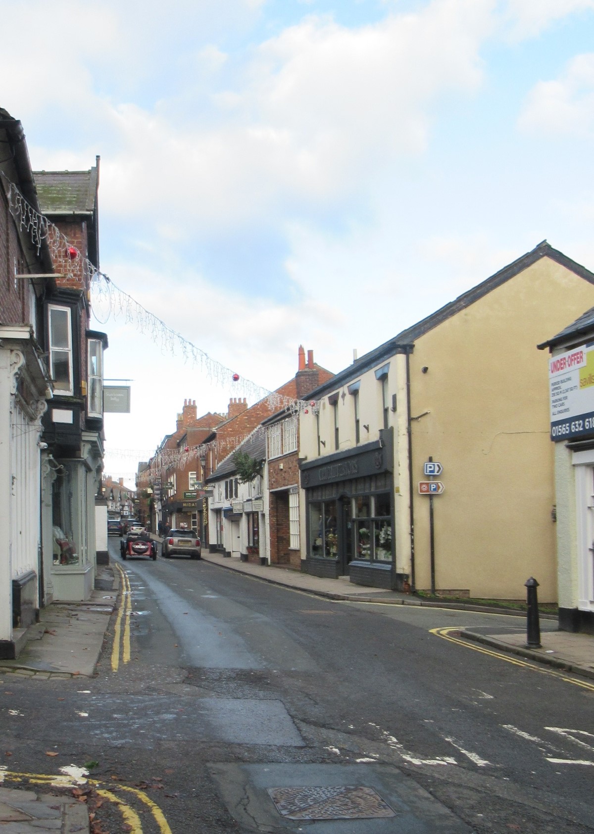
The town of Knutsford was situated on one of the main roads from London to the northwest. A weekly market was held on a Saturday from medieval times. A new market hall, designed by Alfred Waterhouse, was built in 1872 by the Egerton family who had the right to the market tolls. It is now a wine bar. There were also three fairs each year to which cattle were brought from the surrounding countryside. Bear-baiting was a popular entertainment, as indicated by the incident of the bear in the chapel.

The main industry was textiles, initially the manufacture of linen thread from flax grown locally. A silk mill was built in 1770, but both the silk industry and an attempt to introduce cotton spinning failed, perhaps due to inadequate development of the transport infrastructure as industrialisation gathered pace elsewhere.

Knutsford was an important county centre for the administration of justice. From the time of the establishment of the Commission of the Peace for Cheshire in 1536, it was one of the four towns where JPs held their quarterly petty sessions. In the early nineteenth century the county jail and sessions house were built, although quarter sessions had been held in Knutsford since 1575.

The town centre still comprises two narrow streets running almost parallel. The pavements were paid for by Lady Jane Stanley (d. 1803), daughter of the earl of Derby, and were specified by her to be the width of one flagstone. This was said to be because she wished them to be narrow to discourage men and women walking arm-in-arm. She also helped to institute the widespread use of sedan chairs in the town.

Knutsford’s genteel life has been immortalised in Cranford by the Victorian novelist, Elizabeth Gaskell who is commemorated in various parts of the town, including by a building which incorporates a number of influences, including the Arts and Crafts movement. It incorporates a stone bust of her in a niche on its street front and a bronze relief. She spent much of her early life in the town and her husband was minister for a time at the Brook Street Unitarian chapel.

Sources:

Henry Green, Knutsford, its traditions and history: with reminiscences, anecdotes, and notices of the neighbourhood, (London, 1859).

George Ormerod, The History of the County Palatine and City of Chester, (second edition, revised and enlarged by T. Helsby, London, 1882), vol. i, pp. 488-493

Canon J. S. Purvis, Dictionary of Ecclesiastical Terms, (London, 1962), pp. 40-41

‘Knowstone – Kytes-Hardwick’, in A Topographical Dictionary of England, ed. Samuel Lewis (London, 1848), pp. 711-713. British History Online http://www.british-history.ac.uk/topographical-dict/england/pp711-713 [accessed 28 December 2022].

TNA: CHES 14/27, pp. 475-477, 538-541 (with thanks to The Anglo-American Legal Tradition website  http://aalt.law.uh.edu/AALT.html where images of these folios are available).

Click to view fullscreen

Places: Deane


Widget not in any sidebars

Place Type

Parish

County

Lancashire

Parish

Eccles

Deanery

Manchester

Causes

EDC 5/2/1 – Sir Richard Brereton contra William Hilton, Thomas Lee, Hugh Forstar and Peter Bradshaw
EDC 5/3/1 – Sir Richard Brereton contra Thomas Valentine
EDC 5/3/2 – Sir Richard Brereton contra Thomas Valentine


DEANE

Deane was a chapelry of the parish of Eccles, owned by Whalley Abbey, until, in 1541, it became an independent parish in the gift of the Crown by letters patent of Henry VIII, patron following the dissolution of the abbey in 1537. In 1545 the vicar of Eccles deposed that the parishioners of Deane had petitioned for the creation of the parish because they objected to having to contribute to the building costs of Eccles church. The parish comprised the townships of Heaton, Middle Hulton, Rumworth, Farnworth and Kearsley, plus the chapelries of Halliwell, Horwich, Little Hulton and Westhoughton.

Before 1541 the priests who officiated at Deane had been appointed by the vicars of Eccles who paid them an annual salary of £4, but thereafter as they had no power to appoint or remove the new vicar, they refused to pay him. Moreover, they claimed that the income of the parish of Eccles was diminished by the consequent loss of fees.

In February 1538 a lease of the rectory of Eccles ‘and the chapel of Deane, annexed to it’ had been granted to John Penne, the royal barber, who had extensive estates in Hertfordshire. However, because John Penne had not paid the rent the lease was transferred to Thomas Holcroft in 1545.

The parish of Deane was a discharged vicarage which means that any vicar was ‘dischardged and acquited for ever’ from payment of a tax called first-fruits on taking over the vicarage because the value of the living was under £10 per annum.

The church building has apparently developed from a small fourteenth-century building to which additions and alterations were made over the following centuries, some of which were not popular. In 1522 Richard Heaton of Heaton complained to the court of the Duchy of Lancashire that he had constructed an ‘Ile’ within the church, with a ‘chappell of tymbre’ containing an altar where Mass was said regularly. A group of about forty men demolished the wooden structure during the night and got rid of all the timber.

Despite such disagreements, the building was subsequently altered and extended, although the west tower and north doorway are fourteenth century. There was a comprehensive enlargement and reconstruction in the nineteenth century.

In the churchyard is a memorial to George Marsh, the Protestant martyr, who was born in the parish of Deane and taken prisoner while preaching there. Immediately after his arrest he was taken to Smithills Hall in the township of Halliwell, before being transferred to prison and then to Chester, where he was tried in the Consistory Court and burned at the stake in 1555.

A large part of the parish is now within the Bolton conurbation and the textile industry has been important in the area, with handloom weaving and the later development of cotton mills. There were also extensive bleach works in the area. The parish is situated on the Lancashire coalfield and mining became an important industry.

Field names 

named in EDC 5/2/1
derlayglad hey
radford
mutchaw the new marled yerth in the hyll
the newe close mosse Filde
barli crofft
the heythe

horhey medo
steward medo
chodlachmedo

Sources:

Pleadings and depositions in the Duchy Court of Lancaster Part 1, Henry VII and Henry VIII, ed. Henry Fishwick (The Record Society of Lancashire and Cheshire, 32, 1896), p. 111

Pleadings and depositions in the Duchy Court of Lancaster Part 2, Henry VIII, ed. Henry Fishwick (The Record Society of Lancashire and Cheshire, 35, 1897), pp. 197-199

‘Deane – Dembleby’, in A Topographical Dictionary of England, ed. Samuel Lewis (London, 1848), pp. 23-28. British History Online http://www.british-history.ac.uk/topographical-dict/england/pp23-28[accessed 28 November 2022]

‘Salford hundred: The parish of Deane’, in A History of the County of Lancaster: Volume 5, ed. William Farrer and J Brownbill (London, 1911), pp. 1-5. British History Online http://www.british-history.ac.uk/vch/lancs/vol5/pp1-5 [accessed 28 November 2022]

‘Henry VIII: April 1545, 26-30’, in Letters and Papers, Foreign and Domestic, Henry VIII, Volume 20 Part 1, January-July 1545, ed. James Gairdner and R H Brodie (London, 1905), pp. 278-329. British History Online http://www.british-history.ac.uk/letters-papers-hen8/vol20/no1/pp278-329 [accessed 28 November 2022]

Click to view fullscreen

Places: Eccles


Widget not in any sidebars

Place Type

Parish

County

Lancashire

Parish

Eccles

Deanery

Manchester

Causes

EDC 5/2/1 – Sir Richard Brereton contra William Hilton, Thomas Lee, Hugh Forstar and Peter Bradshaw
EDC 5/3/1 – Sir Richard Brereton contra Thomas Valentine
EDC 5/3/2 – Sir Richard Brereton contra Thomas Valentine
EDC 5/9/3 – William Renshaye contra Clement Bent alias Renshaye


ECCLES

The benefice of Eccles had been granted to Stanlow (or Stanlaw) Abbey in Cheshire in the early thirteenth century, and at that time Deane was one of its chapelries. The abbey at Stanlow was situated on the banks of the River Mersey and was liable to flooding, so by the end of the thirteenth century the majority of the monks had moved to Whalley, where the Abbey became one of the most important and wealthy Cistercian houses in the country.

The monks of Whalley provided a vicar for Eccles, which became a parish in the gift of the Crown following the monastery’s dissolution in 1537. In February 1538 a lease of the rectory of Eccles ‘and the chapel of Deane, annexed to it’ was granted to John Penne, the royal barber, who had extensive estates in Hertfordshire. However, because John Penne had not paid the rent the lease was transferred to Thomas Holcroft in 1545.

It was a discharged vicarage which means that any vicar of Eccles was ‘dischardged and acquited for ever’ from payment of a tax called first-fruits on taking over the vicarage because the value of the living was under £10 per annum. Thus, although the Crown retained the rights to all the tithes and other church dues of the parish, the vicar who served the parish was not very well paid.

A plaque in the church records that in 1541 10 townships were separated off to form the parish of Deane. Following this, the parish of Eccles comprised the townships of Barton, Clifton, Pendlebury and the chapelries of Pendleton and Worsley.

The parish church building is in the later English style and although there has been a church here since Norman times, the earliest surviving parts of the present building are said to date from the thirteenth-century, including the base of the tower. Fourteenth-century elements include the arch leading into the south transept and the studded inner door of the south porch. The church may have been built on the site of an earlier chapel as part of a Celtic cross was discovered nearby. The building was comprehensively reconstructed in the fifteenth and sixteenth centuries but then remained virtually unchanged until the nineteenth century when it was, again, substantially restored in 1862. The tomb of Richard Brereton and his wife and son survives from the seventeenth century. The brass plates on the ends of the pews record who was entitled to sit in them.

The church, which is listed Grade 1 on the National Heritage List for England, is now surrounded by high-rise blocks and a shopping centre, and the churchyard has mostly been grassed over.

The area of the parish included part of Chat Moss, moss being the local word for a peat bog. This area was waste until drainage schemes began in the early nineteenth century, and it has now largely been reclaimed. Most of the agriculture in the parish consisted of grazing and there was little arable land until this reclamation. Coal mining had begun in the parish by the sixteenth century and the development of canals in the eighteenth century stimulated development not only of the coal industry, but also textile weaving and spinning. A war memorial in the church records employees of Eccles Spinning Company Ltd. who served in the First World War.

Eccles is a market town, now part of Salford, and has given its name to the famous Eccles cakes.

Field names include:

named in EDC 5/2/1 –
the heythe

Sources:

Dom Gilbert Dolan, O.S.B., ‘Notes on the ancient religious houses of the County of Lancaster’, Transactions of the Historic Society of Lancashire and Cheshire, vols. 43 and 44 (1891 and 1892), pp. 228-229. Available online:
https://www.hslc.org.uk/journal/vol-43-1891-and-vol-44-1892/

The Statutes of the Realm; volume the fourth (London, 1719, reprinted 1963). (1 Elizabeth, c. 4).

‘Eaton-Hastings – Eccleshill’, in A Topographical Dictionary of England, ed. Samuel Lewis (London, 1848), pp. 136-139. British History Online https://www.british-history.ac.uk/topographical-dict/england/pp136-139

‘The parish of Eccles: Introduction, church and charities’, in A History of the County of Lancaster: Volume 4, ed. William Farrer and J Brownbill (London, 1911), pp. 352-362. British History Online https://www.british-history.ac.uk/vch/lancs/vol4/pp352-362

‘Henry VIII: April 1545, 26-30’, in Letters and Papers, Foreign and Domestic, Henry VIII, Volume 20 Part 1, January-July 1545, ed. James Gairdner and R H Brodie (London, 1905), pp. 278-329. British History Online https://www.british-history.ac.uk/letters-papers-hen8/vol20/no1/pp278-329 (vol 20 Part 1, no 19 (9))

Historic England:
Church of St Mary (1067498)
https://historicengland.org.uk/listing/the-list/list-entry/1067498 National Heritage List for England

Click to view fullscreen

Places: Lower Peover


Widget not in any sidebars

Place Type

Chapelry

County

Cheshire

Parish

Great Budworth

Deanery

Frodsham

Causes

EDC 5/1/10 – George Cotton, esquire, contra Margery Holford
EDC 5/1/11 – Francis Holford contra Phillip Holford

LOWER PEOVER 

Lower Peover was a chapelry in the extensive parish of Great Budworth. It was also known as Little Peover, Nether Peover and Peover Inferior. The chapelry comprised the townships of Plumley, Lower Peover and Allostock. It remained part of Great Budworth parish until 1814.

The parish of Great Budworth belonged to Norton Priory before the dissolution, and the Priory supplied a cleric to officiate in the chapel of Lower Peover every Sunday and Wednesday plus various feast days and also to perform baptisms because of the distance from the mother church. Tithes were payable to Great Budworth. Residents of the chapelry were required to supply books, vestments, vessels etc. for the chapel and after the dissolution of Norton Priory they also had to pay the minister.

The earliest parts of the chapel building are understood to date from the late thirteenth century and it remains an excellent example of a timber-framed church building, sympathetically restored in 1852. The brick tower had been added in 1582.

In 1625 a dispute arose between Lady Mary Cholmondeley, who had inherited the property of the Holford family in Plumley, and Mrs Margaret Shakerley, widow of Peter Shakerley of Hulme in Allostock. Lady Mary claimed that Mrs Shakerley had nailed up a door of the chapel thus blocking her family’s usual access into their pew. Further details of this dispute, including some transcriptions of correspondence between Lady Mary and the bishop, can be found in volume 107 of Transactions of the Historic Society of Lancashire and Cheshire (see link below.)

There is a schoolhouse in the chapel yard which was built in 1710.

‘The Bells of Peover’, a hostelry adjoining the churchyard, was built in 1839 and is famous for its wisteria in the Spring. It was patronised by General Patton while he was billeted locally just before D-Day in 1944.

Sources:

William Fergusson Irvine, ‘Disputes at Nether Peover chapel in 1625’, Transactions of the Historic Society of Lancashire and Cheshire,  vol.107 (1955), pp. 141-148. Available online:
https://www.hslc.org.uk/journal/vol-107-1955/

George Ormerod, The History of the County Palatine and City of Chester (second edition, revised and enlarged by T. Helsby, London, 1882), vol. iii, pp. 140-143

CCEd location ID: 5097


Click to view fullscreen

Places: Grafton


Widget not in any sidebars

Place Type

Township

County

Cheshire

Parish

Tilston

Deanery

Malpas

Causes

EDC 5/1582/11 – Richard Massey contra John Brereton


GRAFTON

Grafton was one of the townships of the parish of Tilston in the south west of Cheshire.

It was part of the barony of Malpas.

The image of Grafton Hall in the early nineteenth century is from Ormerod’s Cheshire, courtesy of HathiTrust.


Click to view fullscreen

Places: Carden


Widget not in any sidebars

Place Type

Township

County

Cheshire

Parish

Tilston

Deanery

Malpas

Causes

EDC 5/1560/2 – Joan Fitton, wife of Robert Fitton, contra Ralph Leche


CARDEN

Carden was one of the townships of the parish of Tilston in the south west of Cheshire.

The defamatory words alleged in EDC 5/1560/2 were said to have been uttered in ‘the Commen Town fylde of Carden’. A common field would have been available for use by inhabitants of the township.


Places: Tattenhall


Widget not in any sidebars

Place Type

Parish

County

Cheshire

Parish

Tattenhall

Deanery

Malpas

Causes

EDC 5/1560/2 – Joan Fitton, wife of Robert Fitton, contra Ralph Leche


Places: Tilston


Widget not in any sidebars

Place Type

Parish

County

Cheshire

Parish

Tilston

Deanery

Malpas

Causes

EDC 5/1560/2 – Joan Fitton, wife of Robert Fitton, contra Ralph Leche
EDC 5/1582/11 – Richard Massey contra John Brereton


TILSTON 

The parish of Tilston lies in the south west of Cheshire, on the edge of the Broxton Hills. It comprised the townships of Tilston, Carden, Grafton, Horton and Stretton.

The advowson of the parish belonged to the divided manor of Tilston which was owned by a succession of families, the right of presentation to the living being exercised alternately by the two owners. The rectors owned the tithes. 

The parish church, built of red sandstone, is situated to the south of the village of Tilston, a short distance from the village. The oldest part of the building is the tower, dating from the fifteenth century which retains its original gargoyles. There was an earlier building on the site of which nothing now remains. Within the church a chapel appropriated to Stretton Hall dates from 1659 and is situated on the north side of the building. There was a major restoration of the church by John Douglas in the nineteenth century in the course of which most of the church was rebuilt.

Outside the church, the gate piers in sandstone feature skull and crossbones and the date 1688 is inscribed to the right. There is the base of a medieval cross in the churchyard, which had been altered to incorporate a sundial.

The area of the parish remains largely rural.

Sources:

George Ormerod, The History of the County Palatine and City of Chester (second edition, revised and enlarged by T. Helsby, London, 1882), vol. ii, pp. 694-698


Click to view fullscreen

Places: Over


Widget not in any sidebars

Place Type

Parish

County

Cheshire

Parish

Over

Deanery

Middlewich

Causes

EDC 5/1/8 – Ralph Done, vicar of Over, contra Robert Young, Edward Harrison & Benedict Barker


OVER

The parish of Over comprised three townships, Over with the hamlets of Swanlow and Winsford, Oulton Lowe and Wettenhall. The area of Whitegate was arguably part of the parish, but within the demesne of Vale Royal Abbey. When the Abbey was dissolved in 1538 the vicar of Over claimed that Whitegate was a chapelry of his parish. The controversy was ended by an Act of Parliament in 1542 which confirmed the position of Whitegate as a parish, separate from Over.

The parish was granted to the nuns of Chester by the earls of Chester in the late 12th century, but although rights to the tithes had passed to Vale Royal Abbey by grant and lease by 1475, the nuns retained the right of presentation. Following the surrender of the convent in 1540 the appropriation of the parish passed to the bishops of Chester. 

The parish church of Over, dedicated to St Chad, is situated in a ‘retired glen’ near the banks of the River Weaver set back from the road. It is still almost entirely surrounded by fields apart from a timber-framed building near the gates. This was once the Blue Bell Inn.  The church is unusual in being so secluded as parish churches were more often situated on high ground in a prominent position.

This remote position gave rise to a legend that the church was originally built in the middle of Over but Devil seized it and was carrying it away when the monks of nearby Vale Royal Abbey heard what was happening and began to ring their bells. This caused Satan to drop the church which drifted to earth and landed without damage in its present position.

Despite this unusual episode the building has undergone much reconstruction work over the centuries of its existence and is basically a 15th and 16th century structure, having been comprehensively rebuilt by Hugh Starkey of Oulton in the mid-16th century. In common with many churches, it underwent extensive repairs and was extended during the 19th century and in 1904 the north wall was rebuilt in line with the 1894 vestry extension. The churchyard was extended at about the same time.

The parish now forms part of the town of Winsford, formed in 1894 by combining Over and Wharton. An unusual Boer War Memorial, now housed in the shopping centre, reflects Winsford’s growing civic identity.

The salt mining industry developed in the area from the eighteenth century and Winsford is currently the site of the largest rock salt mine in the country. Other industries, such as engineering, developed during the nineteenth century and after the Second World War large housing developments were built and the population grew rapidly, leading to increased demand for jobs. A development just outside the town proudly advertises itself as ‘Britain’s FIRST industrial Business Improvement District’.

The image of the Devil and Over church is from Egerton Leigh, Ballads & Legends of Cheshire (London, 1867) courtesy of HathiTrust. My thanks to Stuart Allen for drawing my attention to this image.

Sources: 

A P Baggs, Ann J Kettle, S J Lander, A T Thacker, David Wardle, ‘House of Benedictine nuns: The priory of Chester’, in A History of the County of Chester: Volume 3, ed. C R Elrington, B E Harris( London, 1980), British History Online https://www.british-history.ac.uk/vch/ches/vol3/pp146-150 [accessed 28 December 2024]

Tony Bostock, Winsford: a History of a Cheshire Town and its People (Northwich, 2016)

George Ormerod, The History of the County Palatine and City of Chester (second edition, revised and enlarged by T. Helsby, London, 1882), vol. ii, pp. 181-195


Click to view fullscreen

Places: Winwick


Widget not in any sidebars

Place Type

Parish

County

Lancashire

Parish

Winwick

Deanery

Warrington

Causes

EDC 5/1/7 – Agnes Rosbothom contra Robert Haryson


WINWICK

The parish of Winwick, comprising the townships of Newton, Haydock, Winwick with Hulme, Ashton, Golborne, Lowton, Kenyon, Culcheth, Houghton, Middleton and Arbury and Southworth with Croft was in the historical county of Lancashire, but parts are now in the ceremonial county of Cheshire, not far from Warrington.

The parish was said to be the richest rectory in the country and the Stanley family, earls of Derby, were patrons, owning the advowson. The wealth of the living meant that the rectors were often wealthy pluralists such as Thomas Stanley, bishop of Sodor and Man, who also held the parish of Wigan.

The existence of a church in the parish was recorded in the Domesday Book. Although some parts of the medieval building survive, there were many later additions and alterations. In common with a number of local churches the building is said to have been severely damaged by Parliamentarian troops quartered there during the Civil War when two battles were fought nearby.

The chancel was rebuilt in 1847-1849 to designs by A.W. N. Pugin, the celebrated church architect.

A grammar school at Winwick was founded in the mid-sixteenth century after the dissolution of the chantries in Winwick church and refounded with the building of a new schoolhouse in 1618-1619.

Coal mining developed in the area from the late-sixteenth century, industry such as engineering and textiles followed; the construction of the Sankey Navigation, which opened in 1757, further stimulated the coal trade and industrial development. Agriculture is still widespread in the area, however.

The black and white images are reproduced from volumes of Transactions of the Historical Society of Lancashire and Cheshire with their kind permission.

Sources:

T. C. Barker, ‘The Sankey Navigation: the first Lancashire canal’, Transactions of the Historic Society of Lancashire and Cheshire, vol. 100 (1948), pp. 121-156. Available online:  https://www.hslc.org.uk/journal/vol-100-1948/

James Kendrick, ‘Warrington local sketches’, Transactions of the Historic Society of Lancashire and Cheshire, vol. 29 (1876-77), pp. 33-42. Available online: https://www.hslc.org.uk/journal/vol-29-1876-1877/

T. G. Rylands, ‘Winwick and Culcheth in Lancashire: their place in history’, Transactions of the Historic Society of Lancashire and Cheshire, vol. 32 (1879-80), pp. 53-66. Available online: https://www.hslc.org.uk/journal/vol-32-1879-1880/

Rev. W. A. Wickham, ‘Pugin and the re-building of Winwick chancel’, Transactions of the Historic Society of Lancashire and Cheshire, vol. 59 (1907), pp. 132-160. Available online: https://www.hslc.org.uk/journal/vol-59-1907/

Historic England:
Church of St Oswald, Golborne Road (1278428)
https://historicengland.org.uk/listing/the-list/list-entry/1278428 National Heritage List for England

‘The parish of Winwick: Introduction, church and charities’, in A History of the County of Lancaster: Volume 4, ed. William Farrer and J Brownbill (London, 1911), pp. 122-132. British History Online http://www.british-history.ac.uk/vch/lancs/vol4/pp122-132 [accessed 28 November 2022].

Click to view fullscreen